This page displays information on scheduled Hazard Reduction Burns for Queensland.
What is a hazard reduction burn?
Hazard reduction burns are one of the ways we can mitigate the potential impact of a bushfire in the community. They are carried out before a bushfire starts. Essentially, it is a controlled fire that burns some of the fuel on a property, so when a bushfire crosses your path, there is less fuel for it to feed on.
It's one of the many tools we, and our partners, can use to try and limit the intensity and severity of bushfires.
What should I expect during a hazard reduction burn?
Smoke may impact residents and visitors to the area. Residents in the nearby surrounding areas should close windows and doors and if suffering from a respiratory condition, keep medications close by. Smoke can decrease visibility on the roads, so motorists are urged to drive with caution and to conditions.
Please note: The activities on this page rely on information from external sources and may not be complete. If there are no hazard reduction burns listed below, hazard reduction burning activities may still be occurring. If you are concerned about smoke in your area, please check the Queensland Fire Department’s Current warnings and incidents page to see if a warning is current and/or the Permit to Burn page for registered permits in your area. If you or others are in immediate danger, please contact Triple Zero (000).
Planned burn - Kumbarilla State Forest
Where: Kumbarilla State Forest
When: between Monday 6 to Thursday 9 July 2026, weather permitting
Agency: Queensland Parks and Wildlife Service
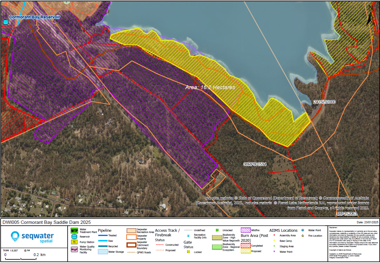
Planned Burn - Wivenhoe Cormorant Bay Saddle Dam
Where: Wivenhoe Cormorant Bay Saddle Dam
When: Wednesday 8 July 2026, subject to conditions
Agency: Seqwater
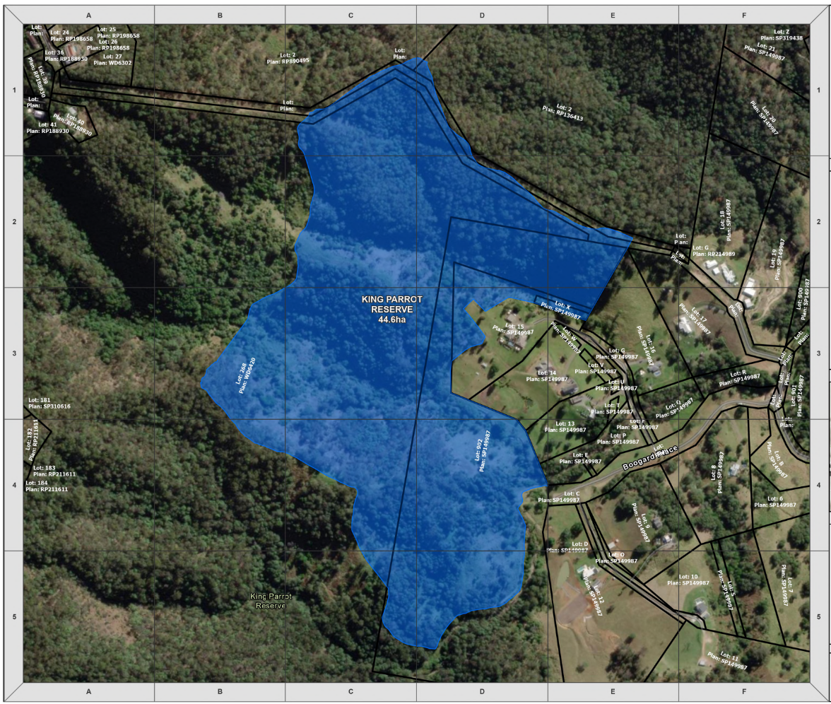
Planned Burn - King Parrot Reserve
Where: King Parrot Reserve
When: Wednesday 8 July 2026
Agency: City of Gold Coast
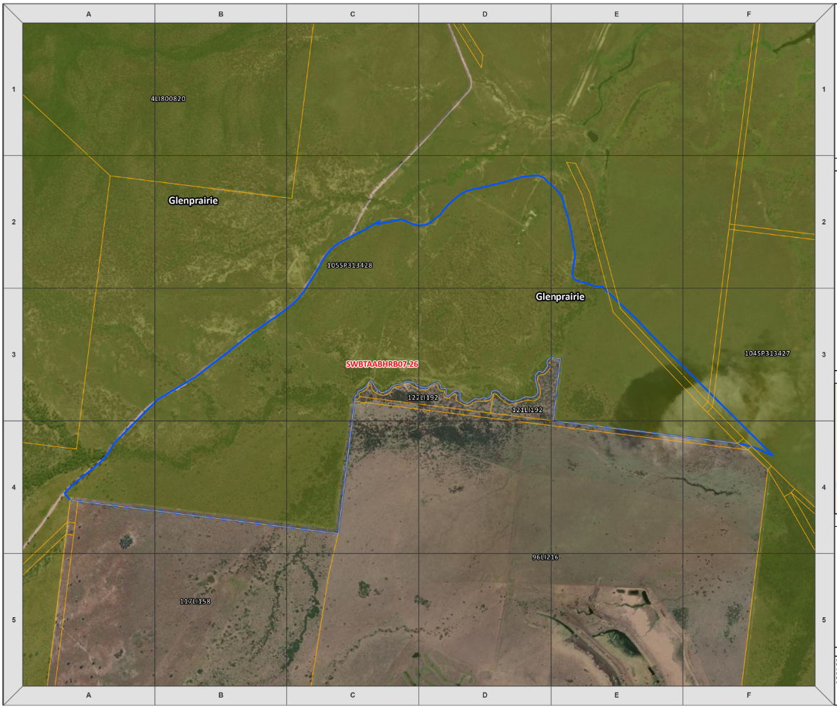
Planned Burn - Shoalwater Bay, Marlborough
Where: Shoalwater Bay Expansion Area, Glenprairie Road, Marlborough QLD 4705.
When: Wednesday 8 to Saturday 11 July 2026
Agency: Downer Defence for the Department of Defence
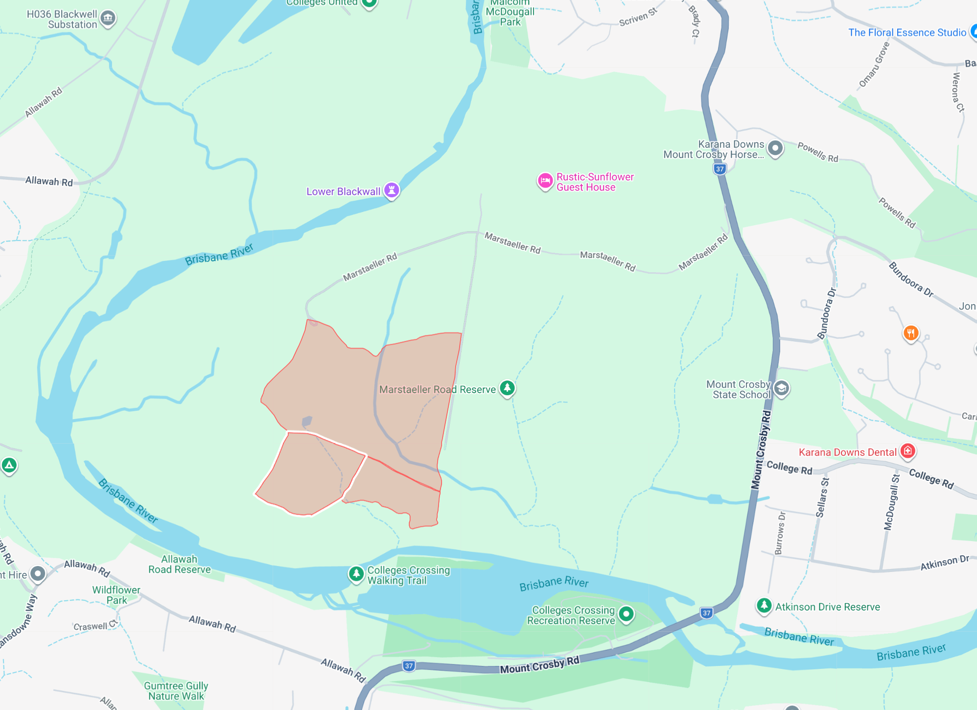
Planned Burn - Marstaeller Road Reserve, Mount Crosby
Where: Marstaeller Road Reserve, Mount Crosby
When: Wednesday 8 July 2026 (subject to final weather and site checks on Wednesday morning)
Agency: Brisbane City Council
Planned burn in Macalister Range National Park
Where: Macalister Range National Park
When: between Thursday 9 to Friday 17 July 2026 (weather permitting)
Agency: Queensland Parks and Wildlife Service